


la salvetat sur agout lac laouzas

ghione
User
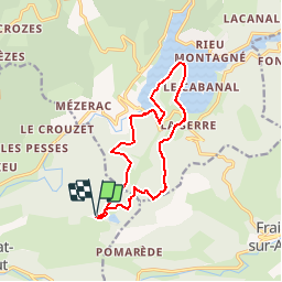

Length
13.4 km

Max alt
970 m

Uphill gradient
412 m
Km-Effort
18.9 km

Min alt
744 m

Downhill gradient
401 m
Boucle
Yes
Creation date :
2018-04-17 17:05:36.809
Updated on :
2018-04-17 17:05:36.809
4h02
Difficulty : Unknown

FREE GPS app for hiking
 SityTrail
IGN / Geographical institutes
SityTrail Plus
The world is yours!
About
Trail Walking of 13.4 km to be discovered at Occitania, Hérault, La Salvetat-sur-Agout. This trail is proposed by ghione.
Positioning
Country:
France
Region :
Occitania
Department/Province :
Hérault
Municipality :
La Salvetat-sur-Agout
Location:
Unknown
Start:(Dec)
Start:(UTM)
479096 ; 4828626 (31T) N.
Comments